Skip to content
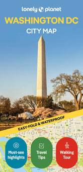


Washington DC City Map
Overview
What's Inside
Durable and waterproof, with a handy slipcase and an easy-fold format, Lonely Planet's Washington, DC City Map is your conveniently sized passport to traveling with ease. With this easy-to-use, full-color navigation tool in your back pocket, you can truly get to the heart of Washington, DC, so begin your journey now!
Durable and waterproof
Easy-fold format and convenient size
Handy slipcase
Full color and easy to use
Extensive street and site index
Images and information about top city attractions
Handy transport maps
Walking tour routes
Practical travel tips and directory
Itinerary suggestions
Covers Adams Morgan, Arlington, Bloomingdale, Capitol Hill, Chinatown, Courthouse, Dupont Circle, Georgetown, Kalorama, Le Droit Park, Logan Circle, National Mall, Penn Quarter, Rosslyn, Shaw, Southeast DC, Southwest DC, Upper Northeast DC, White House Area and Foggy Bottom
Check out Lonely Planet's Washington, DC, our most comprehensive guidebook to the city, covering the top sights and most authentic offbeat experiences. Or check out Lonely Planet's Pocket Washington, DC, a handy-sized guide focused on the can't-miss experiences for a quick trip.
About Lonely Planet:
Lonely Planet, a Red Ventures Company, is the world's number one travel guidebook brand. Providing both inspiring and trustworthy information for every kind of traveler since 1973, Lonely Planet reaches hundreds of millions of travelers each year online and in print and helps them unlock amazing experiences. Visit us at lonelyplanet.com and join our community of followers on Facebook (facebook.com/lonelyplanet), Twitter (@lonelyplanet), Instagram (instagram.com/lonelyplanet), and TikTok (@lonelyplanet).
'Lonely Planet. It's on everyone's bookshelves; it's in every traveler's hands. It's on mobile phones. It's on the Internet. It's everywhere, and it's telling entire generations of people how to travel the world.' Fairfax Media (Australia)
Product Details
- Size3.74" × 7.76"
- Publication dateJanuary 1st, 2025
- LanguageEnglish
- Edition2nd
- Print length2 pages
- ISBN9781787016859
- AuthorsPlanet, Lonely
Buy 2 & Get 10% off
When you add a second book from our expert recommendations, you’ll unlock 10% off your full order. Discount will be automatically applied. Exclusions apply.


You May Also Like
Enhance your travel research with these popular titles that are handpicked to pair well together!