Skip to content

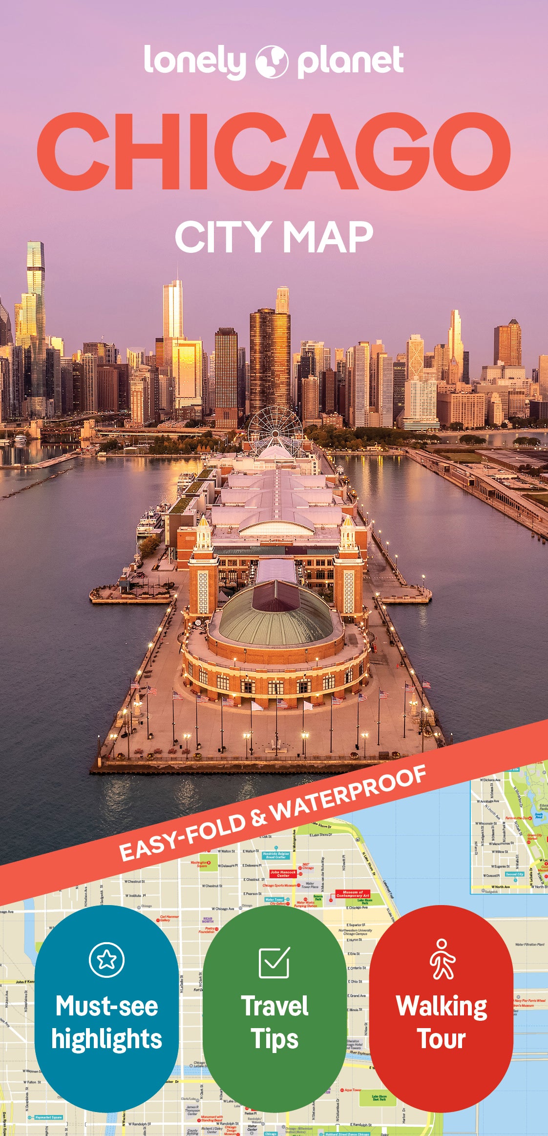

Chicago City Map
Overview
What's Inside
Experience your dream trip with Lonely Planet's Chicago City Map, the ultimate travel tool to help you plan and navigate your way around amazing local sights, landmarks and attractions.
Root for a Cubs win at Wrigley Field, admire masterpieces at the Art Institute of Chicago, mosey out on Navy Pier, and decide where you want to go next and what you want to see in each of the city's exciting neighborhoods.
Inside Lonely Planet's Chicago City Map:
- Full color map in a durable easy-fold format
- Sheet size: 24.8” (630mm) wide x 19.5” (494mm) high, folded size: 3.74” (95mm) wide x 7.76” (197mm) high
- Waterproof and packaged in a handy slipcase
- Alphanumeric grid to find points of interest easily
- Public transport explained to help you get around
- Top picks of must-see highlights including Willis Tower, Chicago Children's Museum, Millennium Park
- Essential travel tips and nuts and bolts information on food & drink, money, spectator sports
- Beautiful photography and bonus zoomed-in map of Greater Chicago, and Lincoln Park & Around
- Covers: Cabrini-Green, Central Station, Dearborn Park, Gold Coast, Illinois Center, Museum Campus, Navy Pier, Near North, River North, Gallery District, South Loop, Streeterville, The Loop
Get ready for your next adventure with Lonely Planet's Chicago City Map, the ultimate navigation tool to help you explore Chicago's well-known attractions and best-kept secrets.
Product Details
- Size3.74" × 7.76"
- Publication dateJanuary 1st, 2025
- LanguageEnglish
- Edition2nd
- Print length2 pages
- ISBN9781787016750
- AuthorsPlanet, Lonely
Buy 2 & Get 10% off
When you add a second book from our expert recommendations, you’ll unlock 10% off your full order. Discount will be automatically applied. Exclusions apply.


You May Also Like
Enhance your travel research with these popular titles that are handpicked to pair well together!